If you're planning a ride in the countryside around Edinburgh, these cycle routes will get you out of the city quickly and safely.
By Mike Lewis
First published: September 2006. Last updated: April 2022
Getting out of Edinburgh by bike couldn't be easier. You won't have to pedal along busy main roads or through endless suburbs. Thanks to the cycle paths and other routes listed here, you'll reach great cycling country in no time at all. These routes are mostly traffic-free, and most are reasonably flat. All of them are signposted.
My aim with this article is not to provide detailed navigational information, but simply to point you in the right direction. If you're not familiar with the area, consult the appropriate Spokes map or other suitable map when planning your ride. (For details of bike routes within the city, see Edinburgh Bike Paths: A Cyclist's Guide.)
The National Cycle Network's Route 1 (NCN 1) is the main northbound cycle route out of Edinburgh. Within the city, it follows the Roseburn and Blackhall paths. These paths, which are based on old railway lines, provide excellent cycling. They are wide, well-surfaced, well-signposted and free of nasty hills.
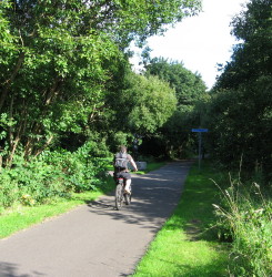
Easy cycling on the Roseburn Path
You can pick up the Roseburn Path at Russell Road, Haymarket Yards (behind the office buildings to the west of Haymarket Station*) or Wester Coates Terrace. Head north. Soon after passing under Queensferry Road, turn half left at the Sustrans marker to join the Blackhall Path.
(*Be careful when cycling near Haymarket Station. There have been several accidents here as a result of cyclists getting caught in the tram lines.)
The path ends a mile later near Silverknowes Road, but you can continue to follow NCN 1 along quiet residential streets through Davidsons Mains and Barnton and on to Cramond Brig.
Immediately after leaving Cramond Brig, there is a slightly confusing path junction. On your right, you'll see a sign pointing to Queensferry (6 miles), Inverkeithing (9 miles) and Blackness (15 miles). The indicated route (which is NCN 76) will indeed take you to South Queensferry and beyond, but it's not the main route, nor the shortest. It offers a very pleasant detour via the Dalmeny Estate, with fine views of the Firth of Forth and the Fife hills. But it will cost you a couple of extra miles of pedalling, some of it on fairly rough paths.
If you prefer a more direct (but less attractive) route, look for a second sign, on your left; this one points to Queensferry (4 miles), Kirkliston (5 miles) and Inverkeithing (7 miles). This is the main NCN 1 route. It initially runs alongside the busy dual carriageway. But don't worry - you won't actually cycle on the main road, and you soon divert onto a quieter thoroughfare. This section of NCN 1 was upgraded in 2014. It is wider than it was before, making cycling considerably easier.
A couple of miles after leaving Cramond Brig (on the main route), turn left along a minor road. You'll pass through the village of Dalmeny and the outskirts of South Queensferry. From here, NCN 1 will take you over the Forth Road Bridge and into Fife, where it connects with the West Fife Cycleway, the circular Kingdom route and several other useful routes.
Cycling across the Forth Road Bridge
Although most motor traffic now uses the Queensferry Crossing (which was opened in 2017), the old bridge is still open to cyclists and pedestrians. And without the traffic noise, cycling and walking over the bridge is much more pleasant than before. The bridge has wide shared-use cycle lanes on both sides, completely segregated from the carriageways (which are still used by buses and taxis). However, because of road works and the presence of contractors' vehicles, one or other of the cycle lanes is often closed. To cross the carriageways to reach the opposite lane, use the underpass at the south end or the lights-controlled crossing on the northern approach. Note that there is a 15 mph speed limit in the shared-use lanes.
Alternative route: NCN 76 to West Lothian and Stirling ("Round the Forth")
Instead of crossing the bridge, you can head west from South Queensferryon along NCN 76, also known as the Round the Forth route. This is a pleasant 91-mile circuit which takes you through Bo'ness, Grangemouth and the northern outskirts of Falkirk, before crossing the Forth at Stirling and returning to Edinburgh via the Fife coast. A very fit cyclist might cover the route in a day, but, for most of us, it's a moderately easy two-day run, with an overnight break in Stirling. Or, by using the frequent train services at Alloa, Stirling, Falkirk Grahamston and Polmont, you can do parts of the route in separate shorter trips.
To reach NCN 76 from South Queensferry, first follow the signs to Hopetoun House. Before you reach the house, turn left on a narrow road, and then right on a track and through two difficult gates. This route is generally well signposted, either as NCN 76 or Round the Forth. Although there are several stretches on main roads, much of the route is traffic-free, and there are no serious hills to worry about.
Alternative route to Winchburgh, Linlithgow and Falkirk
Follow NCN 1 to Cramond Brig, as described above. Continue along the main route (not the Dalmeny Estate detour) for a further three quarters of a mile, then swing left to cross the dual carriageway by a new road bridge (installed in 2020). Continue along this road, passing the former Craigiehall army camp (closed in 2019) and the north side of Edinburgh Airport on your left. After three miles, you'll reach Kirkliston. Follow the B9080 into Winchburgh, from where you can pick up the Union Canal towpath. If you're heading for Linlithgow or Falkirk, this is a shorter but slightly hillier route than taking the canal the whole way (see below).
Approximate distances from the city centre
Cramond Brig, 4½ miles. South Queensferry, 8½ miles. Winchburgh, 10 miles. Linlithgow, 16 miles.
NCN 1 also offers an excellent escape route to the east and south. This too follows a disused railway out of the city, and is well-surfaced with easy gradients.
A good place to join this route is at the Royal Commonwealth Pool in Dalkeith Road. Cycle along Holyrood Park Road, but just before the entrance to the park, turn left into East Parkside. Turn right at the first opportunity, then immediately right again into a driveway to descend into the Innocent Railway tunnel.
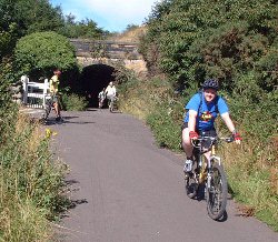
The exit from the tunnel on the Innocent Railway path
Take care when going through the tunnel. Although the lighting has recently been improved, the gradient makes it easy to pick up speed without realising it - to the alarm of other cyclists and pedestrians coming towards you. So watch your speed, and try to maintain single file if you're travelling in a group. (If you prefer to avoid the tunnel, continue along Holyrood Park Road into the park, turn right at the first roundabout, and then take the first turning on the right, down a narrow drive to the far end of the tunnel.)
Once clear of the tunnel, the route is plain sailing. It follows the Innocent Railway path all the way to Brunstane, crossing just two roads along the way. When you reach the car park of The Range (a department store on the former Woolworth site), push your bike over the footbridge which crosses the railway line at Brunstane station. Then turn right, continuing along NCN 1. This will take you along residential roads and bike paths, through Newcraighall, past Musselburgh station, and eventually to the banks of the River Esk. Turn right here.
NCN 1 continues southwards to Dalkeith, Eskbank and Temple. It then climbs steeply over the Moorfoots to Innerleithen, where it turns east. It then follows the River Tweed to Berwick, before turning south again towards Newcastle.
Alternative routes into East Lothian via Musselburgh
Follow NCN 1 to Brunstane station. Instead of turning right after the footbridge, go straight ahead along the signposted Brunstane Burn path. At the end of this path, turn right into the busy Edinburgh Road, which will take you quickly into Musselburgh.
Alternatively, stay on NCN 1 until you reach the River Esk. Then turn left, following the river into Musselburgh. This route is longer than the Brunstane Burn option, but avoids the busy road.
From Musselburgh, the B1348 takes you along the coast to Longniddry. From there, you can take the A198 to North Berwick, or head south along a pleasant four-mile cycle path to Haddington.
Approximate distances from the city centre
Brunstane, 4½ miles. Musselburgh station, 7 miles. Dalkeith, 12 miles.
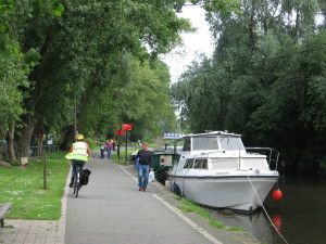
The Union Canal towpath - no hills, no traffic, and impossible to take a wrong turn
The Union Canal towpath carries a section of NCN 75 out of the city to the west. In many ways, this is an ideal cycle path. Navigation is foolproof, there is no traffic to worry about, and, best of all, the going is almost completely flat.
Within the city, the path is often busy with pedestrians, children, dog-walkers and anglers, so ride considerately, and be sure to slow down and ring your bell when approaching the narrow sections under the bridges. This is important; there are occasionally collisions between cyclists and pedestrians on the blind corners under some of the bridges. Care is also needed on the Slateford Aqueduct, where the path is extremely narrow; it's advisable to dismount here.
The towpath starts at the Lochrin Basin in Fountainbridge. This can be reached from behind the Akva bar (by the junction with Gardner's Crescent) or at the Leamington Lift Bridge (go down Leamington Terrace from Bruntsfield). Another good access point is Harrison Park in Polwarth. When riding away from the city, the canal will always be on your left.
The towpath follows the canal along its entire route. It will take you to Ratho, Broxburn, Winchburgh, Linlithgow and beyond. At Falkirk, it connects with the Forth-Clyde Canal to Glasgow. Note that, if you are heading for Linlithgow or beyond, the NCN 1 alternative via Cramond Brig and Kirkliston (described above) is shorter and more varied, although the canal route is flatter and avoids all roads.
Approximate distances from the city centre
Ratho, 9 miles. Winchburgh, 16 miles. Linlithgow 22 miles. Falkirk Wheel: 34 miles.
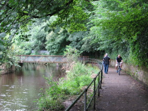
The delightful Water of Leith Walkway, near Dean Village
The 12-mile Water of Leith Walkway, which runs from Leith to Balerno, provides one of the most attractive routes out of Edinburgh. It passes through dramatic steep-sided glens, patches of dense woodland and several of the old industrial villages that have since been absorbed into the city. Designated as an official Urban Wildlife Site, the river is home to mallards, herons, kingfishers, foxes, badgers and otters.
As its name suggests, the Walkway is primarily intended for walkers rather than cyclists. There are places where the path is steep and narrow, and you will occasionally have to dismount - sometimes to haul your bike up or down short flights of steps. Ride carefully and show consideration for pedestrians. There are also several main roads to cross, but fortunately these now all have lights-controlled crossings.
You can join the path at many places along its route, including Stockbridge (Saunders Street), Dean Village and Roseburn Park. Route-finding is easy - just follow the brown signs to Balerno.
After passing through Craiglockhart Dell, the path joins NCN 75, which at this point runs along an old railway line. From here to Balerno, the going is much easier.
The Walkway ends near Balerno High School. To continue along NCN 75, turn right at the path-end, then turn left into Lanark Road West. The signposted route continues to Kirknewton, Livingston and Bathgate, and then on to Glasgow and Greenock. Alternatively, mountain bike users heading for the Pentland Hills can turn left at the path-end, then left again along Bavelaw Road and Mansfield Road.
Alternative route combining the Union Canal and the Water of Leith
For a faster route to Balerno and beyond, take the Union Canal towpath, as described above. At the first bridge after the Slateford Aqueduct (which is two miles from the Leamington Bridge), look for an NCN 75 sign indicating a path to the right. Follow this path as it spirals upward, then crosses the canal and the Lanark Road. The path then drops down to join the Water of Leith Walkway. Continue straight ahead through Colinton to Balerno.
Approximate distances from the city centre
Balerno, 9 miles. Kirknewton, 12 miles. Livingston, 16 miles.
Browse all articles on this site
Further information:
The Falkirk Wheel
Everything you could want to know about the Falkirk Wheel, the Forth and Clyde Canal and the Union Canal
ScotRail
Practical information about taking your bike on the train in Scotland, including details of their cycle rescue scheme.
Spokes
A non-party campaigning group, pressing for better conditions for cyclists in Edinburgh and the Lothians.
Sustrans
The co-ordinators of the National Cycle Network.
Water of Leith Conservation Trust
A charity whose aim is "to conserve and enhance the Water of Leith".
Cycling Edinburgh is maintained by Mike Lewis.
Contact me
Please contact me with your feedback, suggestions or details of events you would like me to include on this site. You can email me at:
© Copyright Mike Lewis and contributors.